Grihayan Limited is a reputed company that provides digital land survey services in Bangladesh since 1990. The company is approved by the Bangladesh government and authorized by the Survey of Bangladesh(SoB) for providing these services. Besides, we believe in quality service and emphasize accuracy as well as client satisfaction. We are committed to supporting our clients according to their expectations and satisfaction until the work is done.
After completing the survey in the field, we provide our clients with a standard printed detailed survey report in both hard and soft copy.
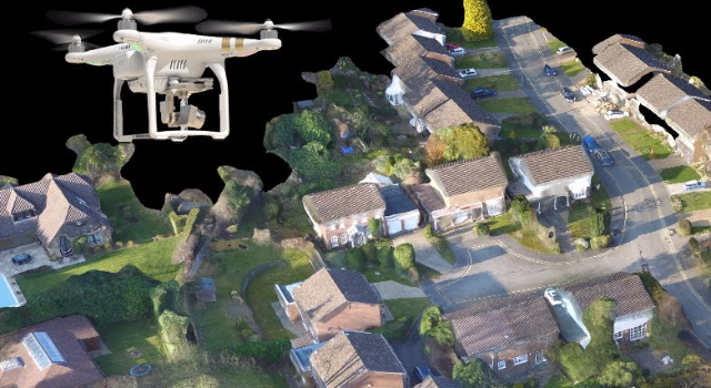
We are leading in the use of advanced UAS technologies (Drone survey & Photogrammetric survey) to provide best-in-class geospatial and surveying solutions in Bangladesh.
Grihayan digital mapping team utilizes leading-edge technology to provide complete mapping data acquisition and processing services for digital photography and airborne LiDAR. We offer precision planimetric and topographic maps, digital orthophotography, digital terrain models, and mapping solutions for projects across our country. We have performed thousands of miles of corridor mapping projects. We produce only the highest quality imagery for our clients. Our orthophotos have a uniform tone and contrast between frames. Our 100% digital photogrammetric workstations are loaded with the latest software for efficiency and we can provide data in all the required mapping formats.
We are one of the leading Geotechnical Engineering Companies in Bangladesh and are capable of providing all related engineering value additions ranging from Field Investigations (offshore and onshore), Field Testing, Laboratory Testing & Analysis as well as Consultancy. Grihayan Limited has 20 years of expertise in providing geotechnical investigation services to the Bangladesh industry. We have sufficient equipment to carry out major geotechnical investigations and have well set up laboratory. Finally, we will give the accurate report for how your land react for different kind of construction materials and types of human risk for human, environments and properties.
As an expert Geotechnical investigation company in Bangladesh, we are offering geotechnical services to all over Bangladesh. If you need best Geotechnical Services for you, Kindly Contact us.
We provide our valuable client a report book of detail soil investigation of their land.
The use of drones in construction has many timesaving, health and safety and cost benefits.
We can track construction progress with photography, aerial video and timelapses. Map the topography of land, provide annotated site maps, 360 aerial panoramas, provide GPS referenced imaging with measurement data and provide stockpile analysis/volumetrics.